
Canal History

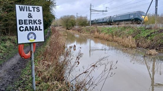
This stretch of canal is a short section of the wider Wilts and Berks Canal network. The Wilts and Berks Canal was promoted in the 1790s to link the Kennet & Avon Canal at Semington (west of Devizes), passing around Swindon and then to the Thames at Abingdon (Berkshire at the time of building, now Oxfordshire). Talks for the whole canal were first held in the RWB town hall in the High Street in 1793, and the Wilts and Berks Canal was officially opened in 1810, the same year as the Kennet & Avon Canal.
To the south of the Coronation Country Park, a permissive path runs along the north bank of the canal, linking the slipway to Woodshaw. At Templar’s Firs, visitors can also enjoy woodland walks between the canal and the railway boundary. The name “Templar’s Firs” dates back to Victorian times, when Francis Templar, the farmer at Brynard’s Hill, gave the area its name.
Canal Features
Hancock’s Water passes under the railway at Woodshaw in a culvert, and it then flows east along the canal under Buxstone Bridge, and it is officially classed as a ‘main river’ until it reaches Woodshaw Spill Weir where it then runs south of the canal and into Brinkworth Brook.
Noremarsh Footbridge, south of the Templar’s Farm Overbridge, crosses over the canal to the towpath. It is wooden, but the original arch bridge was a brick arch bridge used by the farmer.
Further east is Buxstone Bridge, named after the original landowner John Buxstone. This was also an arched bridge south of a pedestrian crossing over the railway, but this has been closed for several years because it is on a bend in the railway. There is a pedestrian railway crossing on a straighter section at Woodshaw, on the border with Harris Croft Farm. The bricks of the abutments of the old arched bridge over the line of the canal can still be seen to the west of this border.


History of the Canal
Timeline
-
1793: Talks amongst the canal proprietors began.
-
1796: Work began at the west end, with bricks for bridges and locks made of local clay, due to the plentiful supply along the route.
-
1800: The canal reached Wootton Bassett; brickworks were set up at Dunnington, south of the town. Two more locks were built east of the town to reach the eight-mile summit level at Chadlington.
-
1804: Swindon Wharf was reached, and the canal then descended through the Vale of the White Horse to the River Thames at Abingdon, finally opening from end to end in 1810.
-
1819 - 1839: The canal made only modest profits over the next 20 years. One of Swindon’s biggest landowners, Ambrose Goddard, played a key role at the time, with many canal company meetings held in the Goddard Arms.
-
1840: Isambard Kingdom Brunel and engineer Daniel Gooch chose Swindon as the site for a major railway works, where the Wilts & Berks and North Wilts Canals met. The canal supplied the railway with water, coal and building materials. The canal thrived for the next ten years, until the railway took over most of the traffic. In the meantime, Swindon expanded rapidly, and the growing town needed many new bridges to cross the canal
-
1901: The Stanley Aqueduct collapsed, and there was not the money to rebuild it. This cut off the northern section of the canal near Chippenham from the western end, allowing the canal to gradually deteriorate.
-
1914: Swindon Corporation applied to Parliament to close the canal. It purchased Coate Water (the main reservoir) and the canal route through the town. Much of it was turned into roads, including Fleming Way, and Swindon Wharf became the site of today’s Magic Roundabout. Outside Swindon, many stretches survived as farm drainage, or sections were sold back to original landowners.
-
1940: The Air Ministry, searching for land to house workers for Lyneham, built 50 houses at Templars Firs, some directly on the line of the old canal. Some of the derelict locks were even used for explosive training by the army.
-
1977: The 'Wilts & Berks Canal Amenity Group' was formed to protect what remained of the canal and to restore short sections. It was later renamed as the 'Wilts & Berks Canal Trust', aiming to protect the whole canal line from new developments.
-
1995 onwards: Templars Firs section was rewatered, and a 1.2 km section was restored and used for the 1996 trail boat festival. Nowadays, work continues to sustainably restore the canal and derelict sections including Chaddington Lock in 2005 and Studley Grange in 2018.
Further Reading/Links
To learn more about local canal history, including activities taking place along the canal, visit the Wilts & Berks Canal Trust website:

Fun fact:
Professional boatmen using the Wilts & Berks Canal for trading referred to it as the 'Ippey Cut', possibly a reference to nearby Chippenham.

With thanks to Steve Bacon and the Wilts & Berks Canal Trust for supporting this project.